Snow, sleet, and freezing rain bring icy conditions statewide Monday

Snow, sleet, and freezing rain bring icy conditions statewide Monday ===
A winter storm is bringing snow, sleet, and freezing rain on Monday. Slick travel and isolated outages are expected across Maine.


Credit: NCM
Significant icing is expected Monday
Author: Christian Bridges
Published: 8:31 AM EST December 28, 2025
Updated: 8:12 PM EST December 29, 2025
![]()
MAINE, USA — A winter storm will continue to impact Maine the entire day Monday. This storm will have a messy, icy mix of snow, sleet, and freezing rain across the state, with big impacts to travel expected.

Credit: NCM
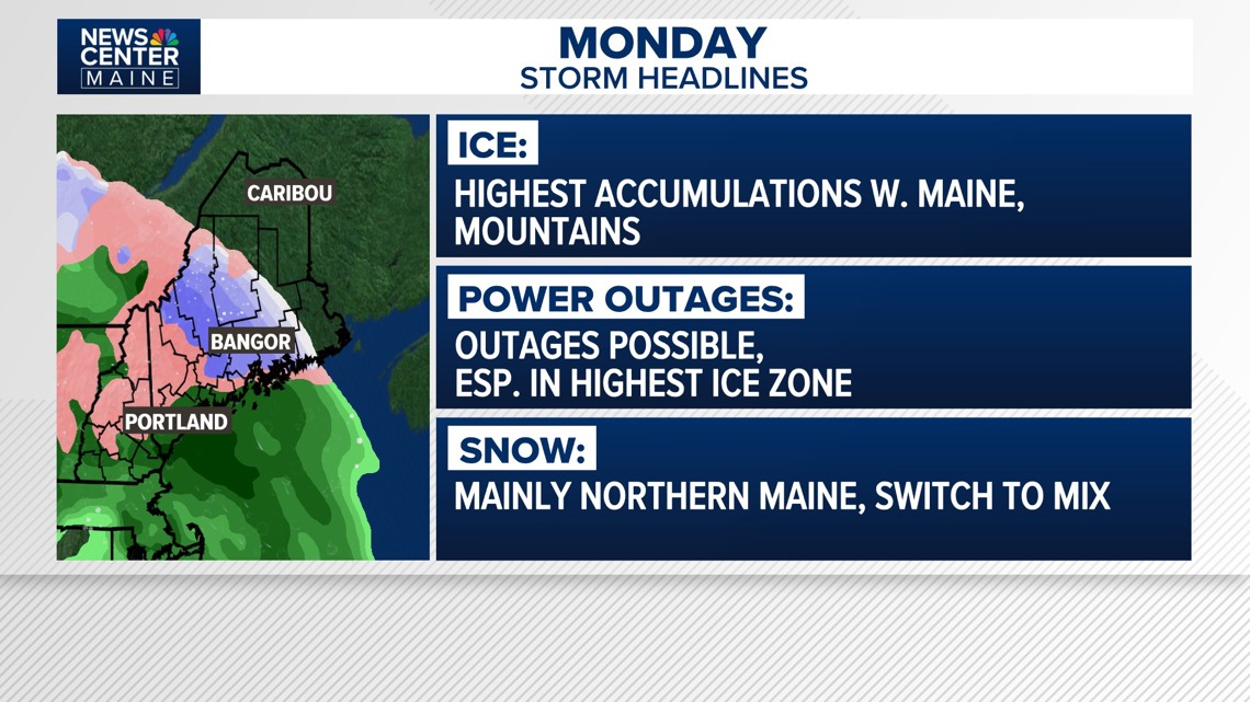
Headlines for the ice storm Monday
Maine State Police responded to around 25 accidents as of 12:30 p.m. on Monday, according to Department of Public Safety spokesperson Shannon Moss. Most of those crashes resulted in minor or no injuries.
Power Outages
As of 8:12 p.m., Central Maine Power reported 246 customers without power. Versant Power reported 3 customers without power. Eastern Maine Electric Cooperative wasn't reporting any outages.
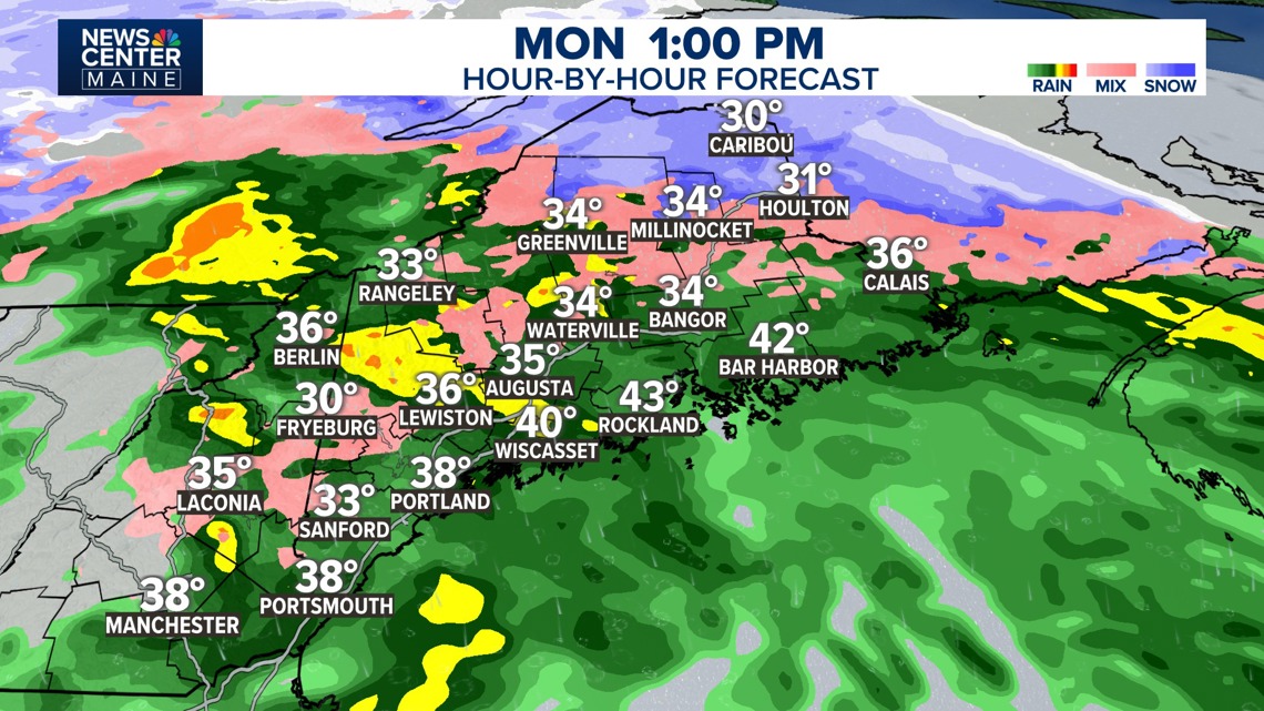
TIMING: Freezing rain will continue inland and into the mountains for the afternoon, with icy travel expected to continue. Closer to the coast, temperatures are near or above freezing. There still can be some icy spots on driveways, sidewalks and parking lots.

Credit: NCM
While most indications are that many areas will change to rain by the afternoon, cold air could keep freezing rain falling in some inland spots.
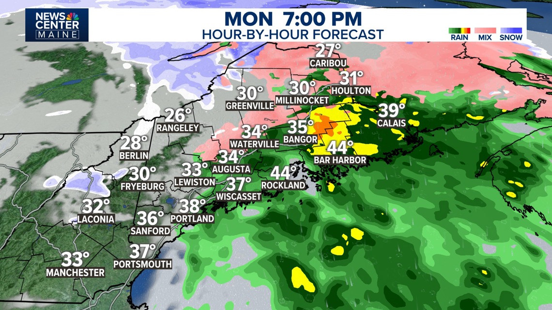
Snow is expected in northern Maine through the day, with some wintry mix possible. The storm will wrap up between 6 and 9 p.m. Monday.

Credit: NCM
The storm will wind down Monday evening
TRAVEL: Freezing rain is often the worst precipitation type for driving, so very slick travel is likely Monday. Along the coast, conditions are expected to improve during the mid- to late morning as we turn to plain rain. Inland areas will keep icy conditions until the afternoon.

Credit: NCM
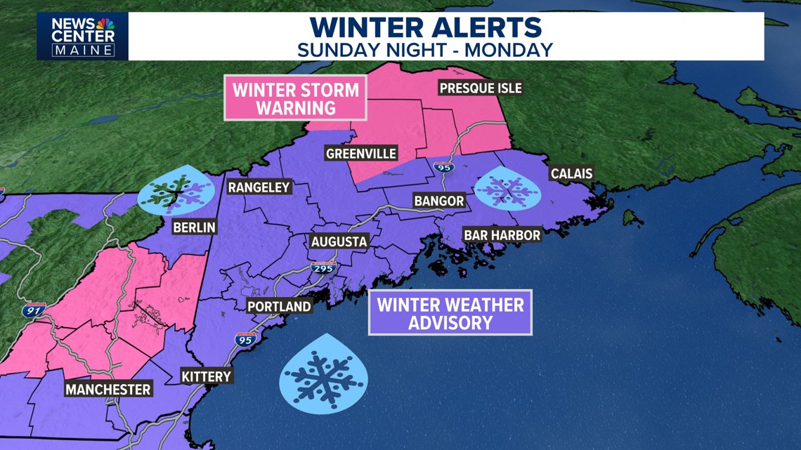
Winter storm warnings have been issued for New Hampshire as we likely near ice storm levels there
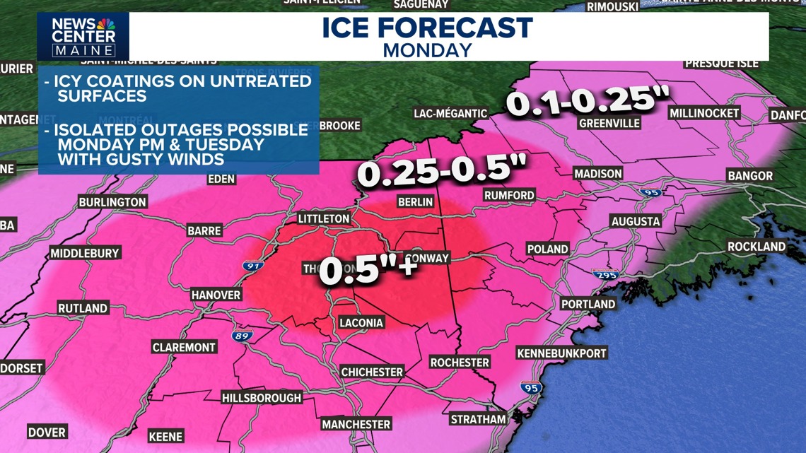
ICE AMOUNTS: Many will see a 10th to a quarter-inch of ice accretion, which includes the Portland area up through Lewiston and Augusta before the change to rain. For western Maine, parts of the mountains, and the lakes region, we'll see higher amounts of ice—likely a quarter to a half inch. Portions of western Maine could see significant icing with a half-inch or more possible.

Credit: NCM
Ice amounts have trended higher. Overall this looks like a more significant event with a high risk of outages western Maine into NH.
This won't be significant enough for major ice storm impacts as winds kick up Tuesday, but we'll see the possibility of at least isolated outages as the wind blows around the ice-laden branches. A change of rain during the morning is expected along the coast. This is likely inland as well, but there is a possibility the cold air lingers a bit longer—especially considering how cold it has been lately. This could increase ice amounts and keep icy travel continuing through the afternoon.

Credit: NCM
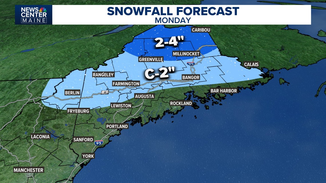
2-4" of snow and sleet is expected on Monday in northern Maine, to the south expect much lighter amounts.
SNOW/SLEET: Many won't see much snow or sleet, but 2 to 4 inches of snow or sleet seems likely in northern Maine. South of there may see a coating or up to 2 inches of snow or sleet before changing over to freezing rain or rain.
The storm will wrap up Monday evening, with frigid air moving in Monday night. It will be cold and windy on Tuesday. This is when the outage potential will be at its highest, as gusts could reach 35 to 40mph.
Stay tuned to NEWS CENTER Maine as we track the storm on Monday!
-Christian
Close Ad
Source: NCM Weather
Locations: Portland, Lewiston, Augusta
Region: Central