Almost 50,000 customers still without power after Friday's strong wind gusts and rain
Almost 50,000 customers still without power after Friday's strong wind gusts and rain ===
Strong southerly winds will result in downed limbs and power lines this afternoon. Some power outages are likely.

![]()
 ===
===
To stream NCM on your phone, you need the NCM app.
Download the NCM app
![]()
![]()
More Videos
Next up in 5
Example video title will go here for this video
Next up in 5
Example video title will go here for this video
Author: Ryan Breton
Published: 6:42 PM EST December 18, 2025
Updated: 1:07 PM EST December 20, 2025
![]()
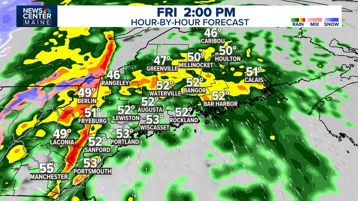
MAINE, USA — It's been a cold month, but we're getting a big warm-up ahead of the next cold front. Temperatures are rising into the 50s, but it's coming with rain and wind.
Fortunately, this isn't a long-lasting storm, so flooding from rain is not a concern. Most areas pick up between 0.5 inch and 1 inch of rain, but there could be up to 1.5 inches of rain in the mountains.
There will be significant snow melt in southern, central, and eastern Maine. The snow pack in the mountains and far north should hold, but it will ripen and compact absorbing the snow.
Rivers and streams aren't much of a concern, but there can be areas of poor-drainage street flooding.
Power Outages
As of 12:45 p.m., Central Maine Power reported 20,917 customers without power, Versant Power reported 21,805 without power, and Eastern Maine Electric Cooperative reported 2,165 without power.

Credit: NCM
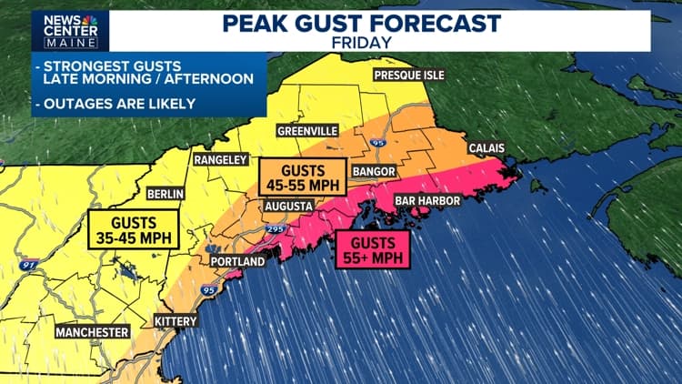
IMPACT AND TIMING
The wind will be the biggest impact.
As the cold front approaches from the west, there will be about a three hour window for strong, southerly winds, during the early afternoon in southern Maine and during the late afternoon in eastern Maine.
Once the front goes by, the wind will change direction, coming from the west, and won't be as strong. A High Wind Warning has been issued from Portland east; this is where there is the greatest risk for outages.
A Wind Advisory is in effect for much of the rest of the state, for scattered outages.
It's a good idea to charge up devices and be ready for an outage.
During the afternoon, southerly winds will gust over 50 mph at times. This won't be a constant wind, but there will be strong gusts especially in downpours.

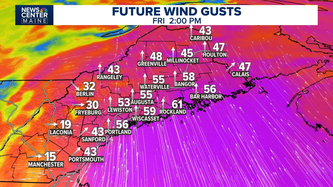
Credit: NCM
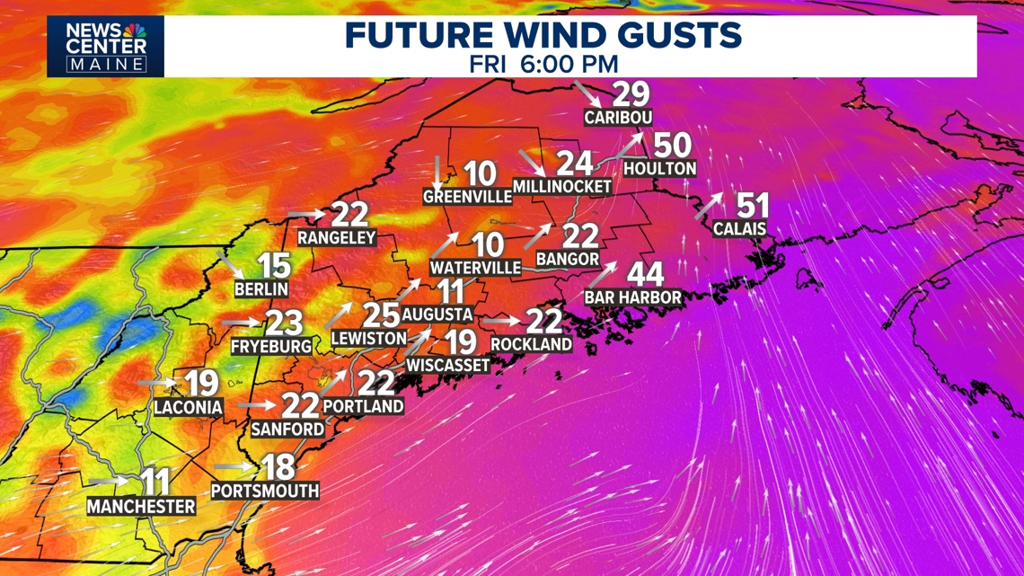
Once the front goes by, the wind will shift and come from the west, and it won't be as gusty. By evening the power outage risk will be much lower.

Credit: NCM
Temperatures will drop behind the front, but it should take several hours to drop from the 50s to freezing.

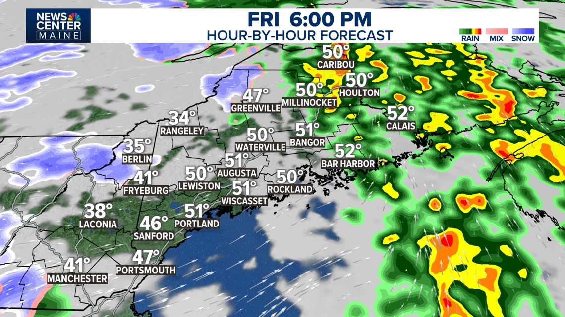
Credit: NCM
A "flash freeze" where all surfaces instantly glaze over isn't expected. However, icy spots will form overnight, and there could be a few flurries. Temperatures by Saturday morning will be in the 20s with colder wind chills.

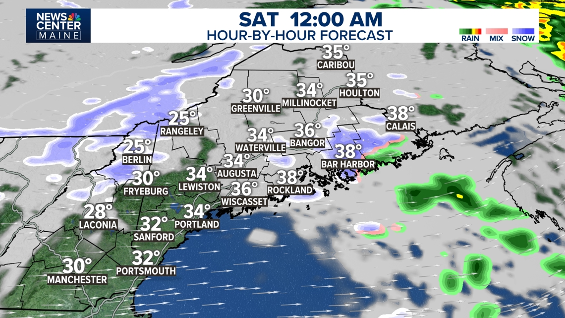
Credit: NCM
Stay with us for updates.
Close Ad
Source: NCM Weather
Locations: Portland
Region: Southern